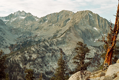
West Vidette
The twin-peaked mountain at left is Deerhorn Mountain. The long ridge reaching down to the north-northwest (right) is called West Vidette. Notice how it ends dramatically in a large triangular face? (the bottom-right part of the triangle is hidden) In the middle of that face is a small lake. Vidette Creek flows down from Deerhorn Mountain in that little canyon on the left. At the extreme upper left is Deerhorn Saddle, over which I went on this trip. I ended up being higher than Deerhorn Mtn, at 13,399' according to GPS.
Picture #394 - copyright © 2006 by John Sherman
